One of my goals for some time has been to build a more powerful windmill to pump water to irrigate a vegetable garden for my family, and eventually our crops of maize, beans and ground nuts (Americans call them peanuts). Maize (corn) and ground nuts in combination provide the main source of protein for my family and the Malawian dish Nsima, made from maize, is our daily staple. My family has a well we dug in 1992 that we manually draw water from using a rope we made from plastic bags, with a empty can at the end that used to contain
cooking oil donated by USAID during a famine last year.
We will need a larger water source if we are to irrigate, and the last thing I want to do is to drill a well which dries up the ground water for others through overconsumption of limited supply. Alfred Maele of National Solar brought a water engineer to conduct a survey of my extended family’s land to determine the feasibility of things like running water in our homes and drip irrigation.

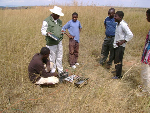
The water surveyor explains to me and my family members how his machine works

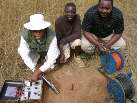
The water engineer, me and Alfred Maele of National Solar
Here is the report. If any of you are water experts, I’d appreciate your feedback on the conclusions.
REPORT ON GEOPHYSICAL SURVEY RESULT CONDUCTED AT MASITALA VILLAGE T/A WIMBE IN KASUNGU DISTRICT ON 08th JULY, 2007
GEOLOGYSICAL METHODS USED:
The method used to identify the site is Electrical Resistivity (ER) and this is capable of picking some fracture zones and determines the quite thickness and the Sub-surface geology. Constant standard transverse (CSTS) were conducted to check on the vertical variation of the quite under investigation. Electrical Resistivity method is also directly related to groundwater occurrence by using two facts of prospecting.
Vertical Electrical Sounding (VES) whereby the distribution of the Electrical Resistivity with depth is studied by progressively increasing the depth of investigation. These investigation (VES)are effective when the geoelectrical horizon are relatively flat lying or gently dipping.
Horizontal electrical profiling whereby the lateral distribution of electrical resistivity is studied by an electrode array for the depth of investigation remains effective when lateral charges are large. It is through the analysis of VES data that groundwater potential and drilling depth is deduced using Schlumberger array.
The Hydro-geological condition is generally good with thin weathered basement rock but potential for groundwater exploitation is reliable. Groundwater flow is generally North/West –East. Water level is roughing from 8m-35m deep, yield of 1.5 litres per second can be obtained if properly developed and designed.
SITE RECOMMENDATION FOR DRILLING.
– Drill up to 60 metres
– Some grave mixed with boulders will be encountered in some depth between 13-25 metres
– Rotary air rig is recommended.
